Google Maps Live Traffic Data Temporarily Disabled In Ukraine
Google Maps Live Traffic Data Temporarily Disabled In Ukraine

Google confirmed on Sunday that it has temporarily disabled some Google Maps tools that provide live information about traffic in Ukraine and how busy places are at a specific time of day.
The company told Reuters it did so to protect local communities in the country. Google and other big tech companies have said they are taking steps to protect users’ security in the region.
As Ukraine faces attacks from Russian forces invading the country, people are using Google Maps to flee and to track traffic jams.
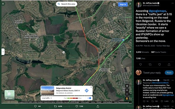
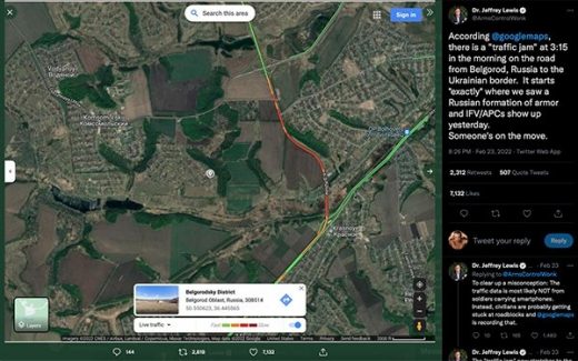
Jeffrey Lewis, a professor at California’s Middlebury Institute of International Studies tweeted that Google Maps helped him identify the Russian invasion into Ukraine even hours before Russian President Vladimir Putin announced the attack, Reuters initially reported.
Lewis used Google Maps data to enrich other data he had gathered about troop formations and movements.
“To clear up a misconception: The traffic data is most likely NOT from soldiers carrying smartphones,” he tweeted. “Instead, civilians are probably getting stuck at roadblock and @googlemaps is recording that.”
What is the wartime protocol for shutting down data sources that are useful to the enemy, asks Shelly Palmer, CEO of the consulting practice The Palmer Group.
“Shutting off location tracking via Maps alone is of little use given cell towers tracking, stingray technology, public Wi-Fi and non-compliant apps,” Blumenthal wrote. “I suppose shutting of busyness and real-time traffic might make it harder to track crowds and or car movement, but even there I assume governments don’t rely on Google or apple for that data but the cellular providers.”
It’s not unusual for location data collected by mapping services to reveal these types of insights. The Verge pointed to two examples. When fitness tracking app Strava released a map in 2017 of user activity, it accidentally revealed the location of several U.S. military bases, showing where soldiers had been running laps around airfields.
Snapchat’s geolocation features have been used to collect images and videos from the frontline in the Iraq War.
Andrew Shotland, CEO at LocalSEOGuide.com, points to quite a bit of chatter on Twitter regarding location data.
(45)


