How A Hacker Helped The Coast Guard Rescue Victims Of Hurricane Harvey
There were countless heroes who helped rescue Hurricane Harvey victims last month. Most of them were in Texas, where the giant storm killed 71 people and caused billions in damage. One was a software developer visiting New York City whose mapping skills provided invaluable real-time information to Coast Guard rescuers.
Greg Sadetsky, a 35-year-old freelance software engineer, was watching from afar when the storm roared in from the Gulf of Mexico. He noticed that people around the world were working together via various online communities–Reddit, Twitter, Facebook, and Slack–to offer assistance. As someone with experience developing mapping software, he decided to build a new map he thought might be helpful to rescuers trying to navigate the ravaged area, and quickly posted it into a Slack group where volunteers were coordinating their efforts.

At first, his project got lost in the mix, but within a few hours, he tells Fast Company, he got an email from Nathan, a lieutenant in the U.S. Coast Guard. Nathan applauded Sadetsky’s map, but noted that it was missing some things that might be useful. Would Sadetsky be willing to help out the rescue efforts by adding a bunch of new functionality that could assist with the dispatch of helicopter crews?
“I said, Of course,” Sadetsky recalls, “and from that point, I was getting [frequent] feature requests from Nathan and his Coast Guard colleagues, and I was implementing those changes on the map . . . If there was something they deemed successful on the map, I added it, and we did that for about a week.”
Sadetsky began to add layers to his map–things like where calls for rescues were coming from, where helicopters were airborne, which missions had been completed, and where helicopters could land. There was also a layer showing no-fly zones–places like the area around a chemical plant, where a lack of power had eventually caused a big explosion.
The map was available on a mobile app and on the web. It allowed the rescuers to toggle between layers in order to see where they were needed next, or which of their helicopters had finished a mission and could move on to the next one. Nathan and his team kept sending Sadetsky new requests, or new information to add to the map, and updated it as fast as he could, often once a minute. By the time the storm had moved on, the map had around 40 different features.
“During that time, it took over my full days, and I was available to them 24/7,” Sadetsky says. “They had my cell phone, and I installed the Zello walkie-talkie app. I didn’t go out of the [house much], but if I did, I had my laptop, so I was available to answer any of their requests.”
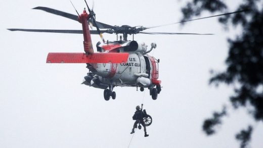
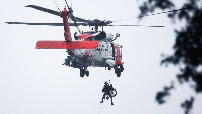
When a storm that brings 130-mile-an-hour winds and drops 50 inches of rain hits populated areas, there are plenty of heroes, and even an effort like Sadetsky’s is but a drop in the bucket. Still, over the worst five days of Harvey, the Coast Guard utilized Sadetsky’s mapping tools on more than 700 missions that resulted in the rescue of more than 1,700 people, as well as getting urgent medical resources where they were needed and helping to evacuate a number of people for medical reasons.
“Initially, our Air Operations Group was struggling with organizing the volume of data that was pouring into our incident command post,” wrote Commander James Spitler of the U.S. Coast Guard Air Station Houston in an email provided by 10x, a talent agency for high-tech freelance professionals that often helps Sadetsky find work. Sadetsky’s “custom mapping software gave our operational managers the ability to organize and view hundreds of calls for assistance, map dozens of designated evacuation areas, and monitor the rapidly changing conditions at area hospitals. Within hours, [his] work gave my pilots a product that was an absolute ‘game changer.’”
For Sadetsky, being able to help with Harvey rescue and recovery efforts from more than 1,500 miles away was an experience he’ll never forget. “The nature of the missions themselves brought home the point that this was critical almost at the very first moment,” he says. “Rescuing people in dire need, people who had disabilities or any medical problems. If they were at the point of asking for that help, that meant that they needed that help. I was helping those who needed the most help.”
Since Harvey, Sadetsky’s map has been set aside, and he’s not aware of it being used for rescue or recovery operations after Hurricanes Irma or Maria. Still, he’s hopeful that some of the features he built might be utilized for similar efforts in the future.
In the meantime, his work on the Harvey map has made him rethink the kind of work he does on a regular basis, making it more likely he’ll want to devote his time and energy in the future to projects that can positively benefit humanity. And it’s had a major impact on his thinking ever since the storm.
“I know a lot of people do a lot of great work,” he says. “I haven’t worked in the emergency field [before], and we can’t all be ambulance drivers. I understand that. But maybe being closer to seeing that, the rescues on the one hand, and everything else on the other hand . . . I kind of feel like I’m still thinking about it a month later.”
About the author
(53)


