How to redesign the Bay Area to fight future climate disasters
When the oldest restaurant in San Francisco was built in 1861, it sat on the waterfront of a creek, serving seafood caught in the neighborhood. The restaurant hasn’t moved, but the creek was buried underground in a culvert nearby, and the marsh that once surrounded the area has been developed, built on debris from the 1906 earthquake. The building now sits on Bayshore Boulevard, a street with several lanes of traffic, sandwiched between two freeways and across from a gas station and a parking lot.
The neighborhood is one of the parts of the Bay Area most at risk from flooding from rising sea levels and severe storms and from earthquakes. It’s also one of nine areas reimagined by teams of architects and designers in a year-long competition to create a “blueprint of resilience” for the region (largely focused on climate change and sea level rise, but focused on earthquakes, as well). The proposal for the area, located in an industrial corner of southeastern San Francisco, suggests partially uncovering the creek, both to better deal with flooding and to bring green space to a part of the city that lacks it.
The competition, Resilient by Design, was inspired by the Rebuild by Design challenge held in New York City after Hurricane Sandy, and funded largely by the Rockefeller Foundation, which also helped fund the work in New York. “We thought, can we do something similar, but before we have a big natural disaster?” says Amanda Brown-Stevens, managing director of Resilient by Design. “Can we proactively think about bringing in design in a creative way to help us reduce flood risk in the future?”
Billions of dollars’ worth of property in the Bay Area is at risk from rising sea levels, including infrastructure like San Francisco’s international airport. As some parts of the city sink, one recent study found that even more land is at risk than previously thought. The low-lying communities that are most at risk as the water rises also tend to have other challenges, including poverty, asthma, and other health issues from pollution, and an increased risk of earthquake damage, especially in areas that were built on rubble on former marshes. The designers looked at resilience holistically–not just how infrastructure might reduce flooding, but how communities could become stronger to bounce back when floods inevitably happen. They also looked at solutions beyond simple seawalls, which can’t prevent flooding if part of the problem is coming from stormwater and high groundwater.
Here are their ideas:
San Francisco, by Big+One+Sherwood
In southeastern San Francisco, the restored creek could absorb millions of gallons of stormwater each year, while the banks could become new public spaces. Right now, the creek ends in a channel near a freeway off-ramp and rail tracks; the naturalized creek would be accessible for the low-income, majority-black neighborhood. The designers propose creating an industrial center, by making the low industrial buildings taller and denser. A wholesale produce market nearby could add urban farming and a culinary school. Sprawling parking lots could disappear or be relocated. Highway 280 could become a ground-level boulevard, and new floating buildings could be moored by the shoreline.
South San Francisco, by Hassell+
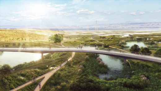
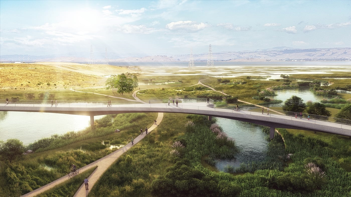
In South San Francisco–a small city with a giant 1920s-era hillside sign proclaiming itself “The Industrial City,” the sea level could rise 55 inches by the end of the century. To help deal with floods that already happen regularly, the designers propose a plant-filled “living levee” that would restore wetlands, and an expanded channel for a local creek with plant-filled walls that can double as public space (and provide a place to cool down as heat waves become more common). A bike-pedestrian bridge could cross rail lines and a highway to provide new access to parks for a community that’s currently disconnected from the bay. A new nursery for native plants below the bridge could also treat stormwater runoff and hold floodwater. Restored wetlands could do the same. The designers suggest that a network of new open spaces around the Bay Area could serve as both collection points for water and connection points where communities can gather in emergencies; creeks and streets could help guide both water and people to the bay.
North Richmond, by Home Team
North Richmond, pinned between a Chevron refinery and a landfill and surrounded by rail lines, freeway, and industry, already deals with widespread poverty, pollution, systemic racism, and chronic flooding. As sea levels rise, it will have to deal with more. The designers suggest building new small houses and creating a community land trust to help more people in the community become homeowners. They also suggest new green infrastructure, including wetland restoration as the current marsh drowns from sea level rise, and 20,000 trees planted to help filter both air and water pollution. Vacant lots could be densely planted with trees to become “air quality parks.” A new overpass would let pedestrians cross the highway to reach the bay; park access could be one way to help deal with the chronic stress of climate change impacts.
Fremont, Union City, and Newark, by Public Sediment
Alameda Creek once meandered through the East Bay, but after repeated floods, the creek was encased in a concrete channel, and the suburbs of Fremont, Union City, and Newark were built up around it. With the water trapped in the channel, sediment that used to flow to the marsh and mudflats near the shoreline–building up the land–is now also stuck in the channel, and the land is subsiding. The team of designers proposes “unlocking” the creek, making it wider and deeper, bringing back plants, and selectively breaching the levee to let sediment flow out and rebuild marshes. The design would give new public access to the creek for the diverse communities living around it.
South Bay, by Field Operations
In the heart of Silicon Valley, from Santa Clara to Mountain View, this design suggests creating the “South Bay Sponge”–a network of wetlands, marshes, wider creeks, mudflats, and other natural areas that can soak up water during storms and then slowly release runoff. (The whole region once acted as a sponge for the Bay Area, but 85% of wetlands have been lost.) The designers also recommend building differently; a typical low office building with a sprawling parking lot could be built higher, with a park in front and a green roof on top to soak up water. Neighborhoods can become denser farther from the water’s edge, while the low-lying shoreline adds new space for recreation.
San Pablo Bay, by Common Ground
Highway 37, which sits on top of a levee next to San Pablo Bay, struggles both with traffic and increasing floods. The levee, like others in the area, cuts off the tidal flow and has caused the land to subside. The designers of this project suggest converting it into an elevated scenic highway, including a bike and pedestrian path, that leaves room underneath for the marsh to return to its natural state. The design also considers better options for transit, including rail.
San Rafael, by Bionic
The low-lying parts of the city of San Rafael, built on mudflats next to the bay, are already at risk from flooding. Though some might think traditional infrastructure could help, such as raising levees or blocking off local creeks, the designers suggest taking a new approach. New development could be concentrated on higher ground and make use of underutilized space. Existing housing in vulnerable areas could be transformed to become more resilient to flooding and earthquakes. A new constructed reef along the shoreline could protect from waves, provide a nursery for marine species, and provide new recreation.
East Oakland and Alameda, by ABC
San Leandro Bay was once a shallow bay surrounded by marshes and mudflats that helped provide flood resilience further inland, but in the 1870s, a canal was cut through the area–isolating the city of Alameda–and coastal wetlands were filled in with urban rubble and sand. Both East Oakland, a low-income, mostly black community that struggles with pollution and housing loss, and Alameda are now at risk from flooding as the sea and groundwater rise. The design team proposes creating a network of ponds, expanded streams, and other green space that can absorb and filter water. New affordable housing would help residents stay in the community; some of that housing could include prefab floating homes on tidal lagoons. A new transit hub could provide more connections to work.
Marin City (and everywhere), by P+SET
Rather than proposing a design for a specific location, this team suggested a new social design process that could be used anywhere. Some of the communities most at risk from sea level rise are also dealing with poverty, racism, stresses like food insecurity, and the threat of displacement. “Engaging” a community typically happens in a limited way, but in this new process, the community helps lead–creating a vision for the neighborhood, assessing current assets and problems, and devising strategies and a timeline to implement solutions. The designers tested the process with community members in Marin City, a small, low-income, diverse community at the bottom of a watershed that frequently floods. Sea levels in the area are already eight inches higher than they were 100 years ago.
Unlike in New York, where disaster recovery funds were available for new designs–and seven projects are moving forward, though because of the complexity, none have yet broken ground–it’s not yet clear how Bay Area cities and counties will use the concepts. But the intent is to help build the ideas into plans for replacing outdated infrastructure. After the teams present their final ideas this week, a group of stakeholders will meet to talk about how to begin making the suggestions reality. No one idea will “win” the competition; each of the teams, initially selected by a jury in order to participate, has put forth designs that could potentially be implemented. “Everything we’re trying to do is focused on building interest and support for local governments and agencies to move these forward,” says Brown-Stevens.
Correction: This article has been updated to more accurately reflect the San Francisco proposal’s ideas for industrial buildings and parking lots.
(46)


