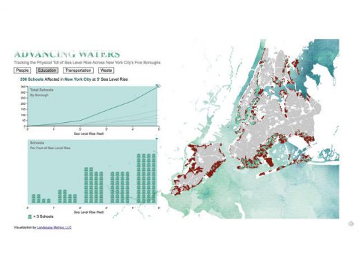
Measuring What Exactly Will Be Destroyed As New York’s Sea Levels Rise
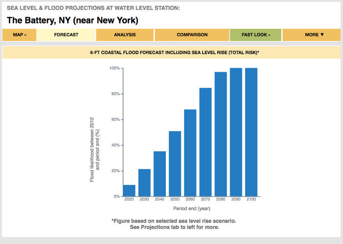
Sea levels along New York’s coastline have risen about one foot since 1900. By the end of this century, they’re predicted to rise another one to seven feet, according to a 2014 New York State report.
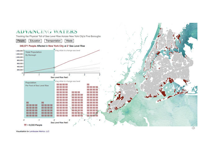
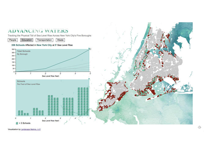
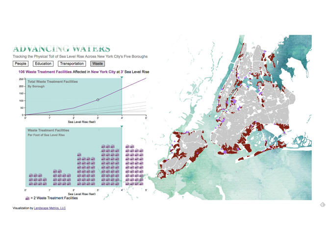
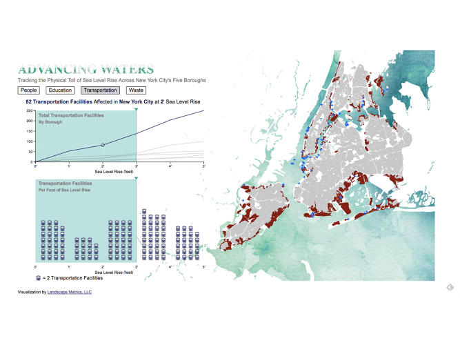
You can see what that means for the city of New York in these visualizations, which come from Landscape Metrics, a young Brooklyn-based design firm.
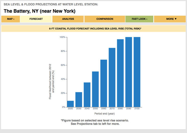
“Sea level rise means displacement—the potential relocation of hundreds of thousands of people, hundreds of schools, hundreds of facilities that provide services to the entire city,” says Benjamin Wellington, the firm’s principal. “Climate change can be easy to ignore in large part because it is so abstract. This is an attempt to make it more tangible and inspire civic action.”
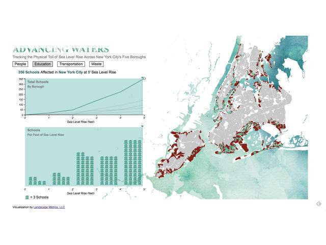
Landscape Metrics used data from the U.S. Geological Survey’s National Elevation Dataset, coupling it with New York City data covering infrastructure (schools, waste facilities, etc.) in the area.
“Brooklyn appears to be at the greatest risk, but all boroughs are significantly affected by rising seas,” Wellington says. “Seeing the scale of displacement throughout the city really drives home the point that we need to start planning for adaptation immediately.”
Have something to say about this article? You can email us and let us know. If it’s interesting and thoughtful, we may publish your response.
Photo: Michael Bocchieri/Getty Images
Sea levels could rise up to seven feet by the end of the century. This shows the population that will be displaced with each extra foot of water.
And the schools that will be flooded
Waste treatment centers
Transportation facilities
Sea level rise won’t just mean the coasts are a little closer. It will require wholesale redesigning of our current coastal cities.
Fast Company , Read Full Story
(68)

