NASA reveals pollution maps gathered by the TEMPO space instrument
NASA launches powerful air quality monitor to keep an eagle-eye on pollution
It even spots changes on a neighborhood level.

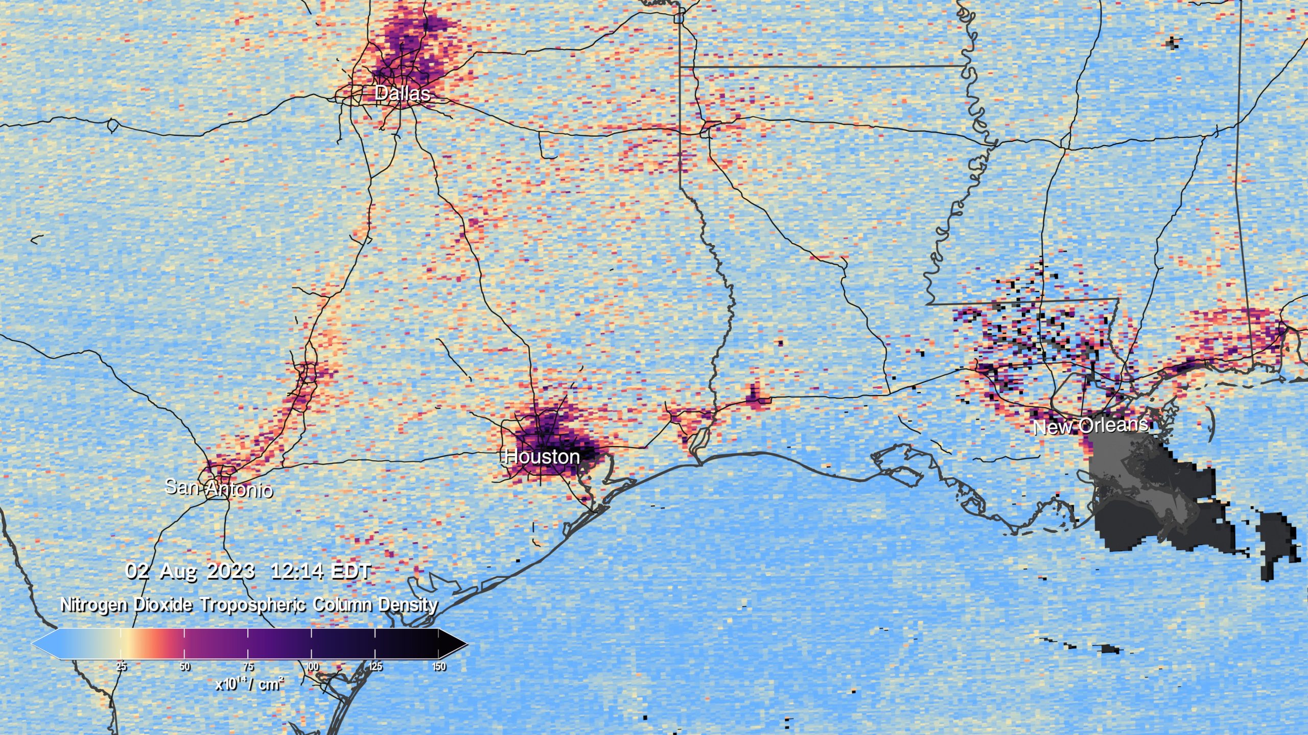
NASA has launched an innovative air quality monitoring instrument into a fixed-rotation orbit around Earth. The tool is called TEMPO, which stands for Tropospheric Emissions Monitoring of Pollution instrument, and it keeps an eye on a handful of harmful airborne pollutants in the atmosphere, such as nitrogen dioxide, formaldehyde and ground-level ozone. These chemicals are the building blocks of smog.
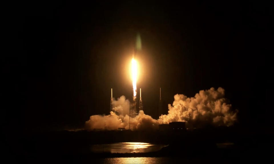
TEMPO traveled to space hitched to a SpaceX Falcon 9 rocket launching from Cape Canaveral Space Force Station. NASA says the launch was completed successfully, with the atmospheric satellite separating from the rocket without any incidents. NASA acquired the appropriate signal and the agency says the instrument will begin monitoring duties in late May or early June.
TEMPO sits at a fixed geostationary orbit just above the equator and it measures air quality over North America every hour and measures regions spaced apart by just a few miles. This is a significant improvement to existing technologies, as current measurements are conducted within areas of 100 square miles. TEMPO should be able to take accurate measurements from neighborhood to neighborhood, giving a comprehensive view of pollution from both the macro and micro levels.
This also gives us some unique opportunities to pick up new kinds of data, such as changing pollution levels throughout rush hour, the effects of lightning on the ozone layer, the movement of pollution related to forest fires and the long-term effects of fertilizers on the atmosphere, among other data points. More information is never bad.

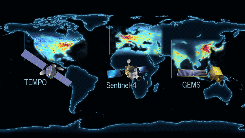
TEMPO is the middle child in a group of high-powered instruments tracking pollution. South Korea’s Geostationary Environment Monitoring Spectrometer went up in 2020, measuring pollution over Asia, and the ESA (European Space Agency) Sentinel-4 satellite launches in 2024 to handle European and North African measurements. Other tracking satellites will eventually join TEMPO up there in the great black, including the forthcoming NASA instrument to measure the planet’s crust.
You may notice that TEMPO flew into space on a SpaceX rocket and not a NASA rocket. This is by design, as the agency is testing a new business model to send crucial instruments into orbit. Paying a private company seems to be the more budget-friendly option when compared to sending up a rocket itself.

(11)


