These White Christmas maps will tell you if you can expect snow in 2018 (or historically)

By Christopher Zara

For reasons I’ve never been able to fully comprehend, a lot of people like snow. And with the Christmas holiday coming up next week, millions of Americans may be wondering if a proverbial White Christmas is in their near future. Despite the enduring popularity of that Bing Crosby-anointed phrase, White Christmases are relatively rare to nonexistent throughout much of the country. And one assumes that situation has not been helped by climate change.

Nevertheless, if you’re curious about whether you will wake up under a blanket of snow on December 25—or if your area is typically prone to the white stuff on Christmas—I’ve rounded up a few maps to help you. If you’re like me and prefer clean sidewalks and dry socks, you can also use these maps to find out where you can keep living the slush-free life. Either way, enjoy your holiday!

    The Weather Channel has a dedicated White Christmas page with radar maps and snow forecasts. (The network defines this as at least one inch of snow.) As of right now, the best chances are in the Pacific Northwest and northern New England, which are the areas currently covered in snow. Find the maps here.

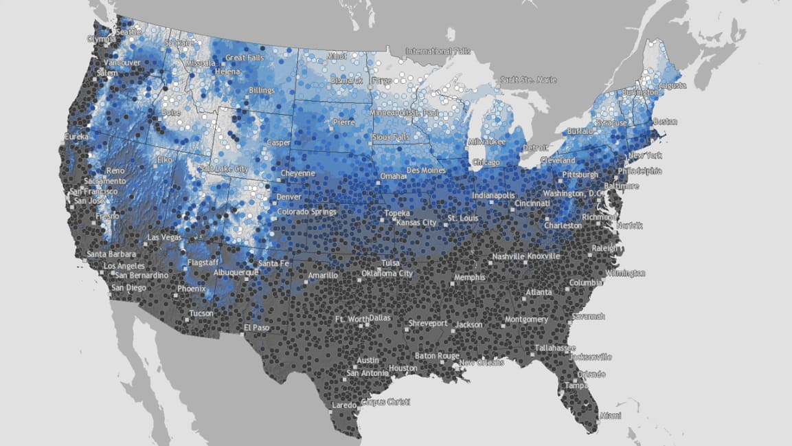
    NOAA’s National Centers for Environmental Information have a really cool resource for snow lovers who want to know if their area is historically prone to White Christmases. Using climate record data from 1981-2010, NOAA’s interactive map lets you zoom in on your exact location and find out the historical likelihood of getting at least an inch of snow on Christmas. I just looked at the data for Manhattan, and apparently we have an 11% chance here. The full map is color-coded, so you can see which areas normally have snow cover, and which ones almost never do. Find the map here.

Fast Company , Read Full Story

(22)