This $8 billion development was designed to survive rising seas
When developers at HYM Investment Group started planning a major urban redevelopment at the former Suffolk Downs racetrack near Boston Harbor, they knew they had to plan around water.
The site is surrounded and even intersected by flood potentials—Sales Creek runs through the middle of the former racetrack, Chelsea Creek runs alongside it, there’s an adjacent tidal marsh, and, perhaps most significant, the Atlantic Ocean is less than half a mile away. These are known risks, and some measures have already been taken to prevent floods, including the use of tide gates and a 40-year-old pump station.

The developers knew these preexisting protective infrastructures had limits. But they didn’t know what those limits were, or how big a problem flooding could be. The best available flood maps for the 161-acre site, and for most places in the U.S., are flood insurance maps produced at the county level for the Federal Emergency Management Agency, and these are notoriously inaccurate.
To find out exactly what kind of future risks the site faced, HYM commissioned one of the most extensive hydraulic models ever created for an individual development. The resulting model has taken into account the various factors that will likely make water levels rise around the world, from heavy rainfall events to surging tides to inevitable sea level rise. With this information, the 16.2 million-square-foot Suffolk Downs project has been designed specifically to avoid flood damage and manage the waters when they come.
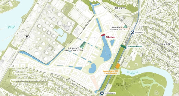
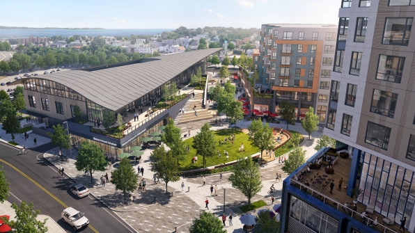
“From day one we set out to make this site resilient, not just for today, but through 2100,” says Doug Manz, director of development at HYM Investment Group. At full build-out around 2040, the project is planned to include 10,000 housing units, 5.2 million square feet of offices, 850,000 square feet of hotel and retail space, and a 40-acre network of public open areas that will make up a full quarter of the total site. Through selectively placed embankments and a site layout that will concentrate any flooding in that open space network, the project was specifically designed to protect itself from flooding in the future.
The developer hired the engineering and planning firm VHB to help understand how water could affect the site, and how its worst impacts could be avoided. With FEMA’s flood insurance maps as the baseline information, VHB had to reanalyze the entire site and the surrounding area, both of which are facing risks that go beyond the scope of flood insurance.
“These studies are well known to be incorrect quite a bit of the time,” says Mark Costa, a water resources project manager and engineer at VHB. “This flood study doesn’t include Sales Creek, doesn’t include the pump station, doesn’t include the tide gates, and, really important for us, doesn’t include sea level rise.”
The model that VHB produced maps the area in minute detail, and is capable of simulating heavy rainfall, tidal surges, and projected sea level rise in the short and long term. “Suffolk Downs is probably the biggest and probably the first-of-its-kind study where we did this level of modeling for a specific project,” Costa says.
To understand the forces that could affect the site, VHB and the developers put the model through the works. “The first time we ran it, we ran 50 different scenarios,” Manz says.
They modeled storm events today, as well as those projected to occur in 2035, 2070, and 2100, each with different parameters, such as 10 inches of rainfall in a 24-hour span, concurrent gravitationally influenced king tides, and sea level rise of 1 foot to more than 5 feet. “It got to the point where we ran probably way too many scenarios,” Manz says. “We probably went though more effort and cost, but I think it was a learning experience.”
Eventually the modeling was narrowed down to about 10 scenarios, with different time horizons through 2100. Important to the process was looking at worst-case scenarios, like the unlikely convergence of the high coastal surge of a winter’s nor’easter storm and a heavy rainfall event typically experienced during the summer.
“It was quite extraordinary that we could see over a 24-hour to 48-hour storm where the water was building up, where it would break through, where it would flood onto our site,” Manz says. “It showed us what we need to do on-site in terms of stormwater capacity as well as to mitigate coastal surge at the same time.”
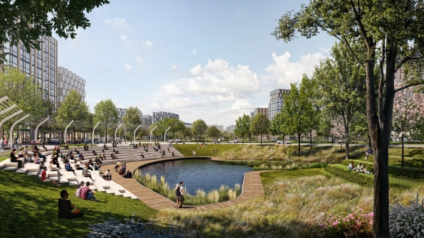
By revealing the parts of the site that were particularly prone to flooding, these modeled scenarios ended up dictating how the project was planned, and where additional protections are needed. “The modeling really drove the design of the project, the grading, where to place the flood storage, where to place a berm,” Costa says. “The modeling was really key in understanding that.”
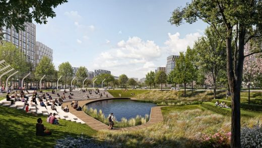
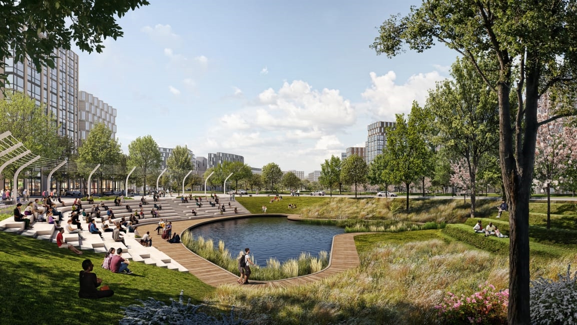
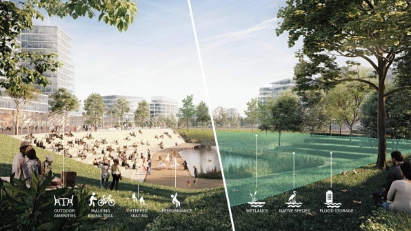
The resulting design integrates a series of floodable linear parks all connecting to one large open space near the center of the site, which the modeling showed would be the most likely to be inundated during extreme weather events. The central park is designed to flood when necessary. And when the waters recede, it can go back to being an open green space. “We looked at all those open spaces as the first line of defense for being able to absorb, treat, and integrate stormwater infrastructure while not limiting their active uses,” Manz says.

The $8 billion project is now in the beginning building stages. Crews will be breaking ground this year on the residential structures near one of the transit stations that border the site. Manz says the site’s plan and the modeling also take into account the 20-year timeline for building the project, and the flood risks that will evolve during that time. It’s a way to let the site adapt, but also to more affordably spread out the construction of mitigation measures.
“We look at improvements that could be done at each phase, so that way we don’t burden any one phase with the entire infrastructure requirement,” Manz says.

This level of modeling and planning is relatively new in coastal development, mostly because the planning and engineering community is just beginning to understand the implications of sea level rise. “We just weren’t concerned with adaptation and sea level rise even five, six, seven years ago,” Costa says. “It’s really the last five years that we’ve been proactively planning.”
He expects this type of modeling to become more common, especially for big projects like Suffolk Downs—projects facing multiple tidal, coastal, and weather threats. As sea levels rise, that will likely apply to more and more sites around the world. “It’s going to be interesting to see where this goes in the future,” Costa says.
(22)

