When we try to plan for the future, we often, ironically, look to the past. If you want to purchase a home, for example, you might check to see if it’s in a flood zone. But FEMA flood maps, used as a way to identify an area’s flood risk, are actually based on historical storm data, and don’t take climate change into account.
In Hawaii, one county is changing how it plans for the future by actually looking at future projections. Kaua’i County, which is made up of the islands of Kaua’i, Ni’ihau, Lehua, and Ka’ula, has adopted an ordinance requiring newly built or renovated structures to be elevated to a certain level, based on projections about how much the sea level will rise.
“We know sea level rise is occurring, and there are a variety of associated hazards, whether it’s shoreline erosion or just general passive flooding,” says Alan Clinton, administrative planning officer at the County of Kaua’i. “It seemed very, very prudent for us to be cognizant of the hazards of the 21st century.”
The same FEMA flood data that shows whether your home is in a flood zone also sets standards for how elevated structures should be. But again, that data comes from just looking at past storms and floods—and FEMA is only required to review those maps every five years. This is where the new ordinance comes in, by baking future sea level predictions into the permitting process for new buildings. “We know that when we permit a structure, it will exist for 70 to 100 years in the future,” Clinton says. “Why are we not taking information and data about the future into account during these permitting processes?”
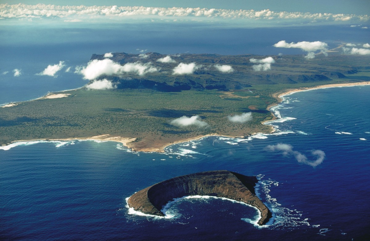
As an island, Kaua’i is particularly vulnerable to sea level rise. According to the National Oceanic and Atmospheric Administration, sea levels along Hawaiian Island coastlines are projected to rise an average of 5 to 8 inches by 2050 alone. With rising sea levels comes coastal erosion and inland flooding, which threaten the islands’ food security, water supply, housing, economy, and cultural practices. On average, flooding is associated with $4.7 billion per event in damage. Between 1980 and 2023, inland flooding events in the U.S. have caused $191.2 billion in damages.
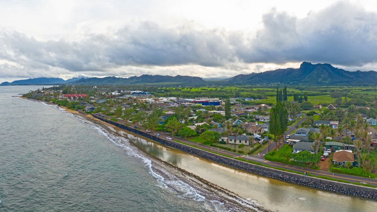
In Hawaii, sea walls aren’t seen as a solution to rising oceans. “First and foremost, the beach areas are culturally significant, “Clinton explains. “And as soon as you put in a seawall, that beach is gone forever.” Hawaii actually has a prohibition on sea walls, but loopholes have resulted in some being built, with destructive consequences, where the waves just end up cutting away at the neighboring properties.
The Kaua’i County ordinance uses data from the University of Hawaii Manoa Climate Resilience Collaborative, including model projections that show where coastal flooding and erosion can be expected when sea levels rise. The ordinance was officially signed into law in October 2022, but finding the best way to present the data to the public was a challenge. Since its passing, the county has created digital tools that better communicate the data, using mapping company Esri, rather than just PDFs or flat maps.
In one of the tools, the Kaua’i Sea Level Rise Constraint District Viewer, users can zoom in on map and see projected elevations for both passive flooding and wave runup and overtopping, which refers to the increase in water from waves breaking along a shoreline. Someone can click on a specific lot of land in the map and see what height they’d need to elevate a structure to in order to avoid any of those risks. New structures (or renovations on existing ones) are required by the ordinance to be elevated two feet above the highest sea level rise that intersects with that lot. (The sea level rise data is based on an Intergovernmental Panel on Climate Change report of 3.2 feet of global mean sea level rise by 2100.) “These tools allow us to, at the building scale, get very particular, and require folks to elevate their structures to accommodate these hazards in the future,” Clinton says. The county also created a 3D animation to show what that looks like.
The ordinance isn’t just making recommendations about how people deal with rising sea levels: “These are hard and fast requirements,” he says. It also doesn’t just help future homeowners, but better informs everyone, from realtors to insurance agents, about climate change and coastal development.
It’s novel that future data like this is baked into policy requirements—but it could be done with a range of climate risks, like wildfire hazard zones (which are especially relevant given the recent fires that have devastated Maui). “Anybody with a [scientific] model can now kind of incorporate that into their regulatory framework,” Clinton says.
There are still limitations, though. There’s an international scientific consensus on sea level rise predictions, but there isn’t the same level of consensus on other climate risks, like atmospheric modeling that could predict rainfall or winds that drive wildfires. “This bill does address the slow creep of sea level rise over time, but we do realize that the greatest impacts that we’re going to experience here on Kaua’i due to climate change are the increasing intensity and frequency of storm events,” Clinton says. “This bill does not address that.”
Still, there’s reason to be hopeful—and to expect more predictions built into policies and regulations. “This was sort of a proof of concept to incorporate that future data into our regulatory framework,” Clinton says of the Kaua’i ordinance. “Now we’re looking at more advanced, higher quality models that we can do the same thing with that are really on those more devastating hazards.” It’s something that could extend beyond Hawaii, too, to any other state facing threats from climate change.
(43)