This interactive map shows how fishing is killing sharks
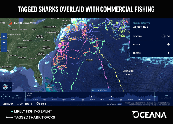
Using satellite data and machine learning, a nonprofit called Global Fishing Watch maps fishing boats around the world to help crack down on illegal fishing. The map’s coverage of the Atlantic Ocean now has a new layer–the routes taken by 45 sharks wearing tags.
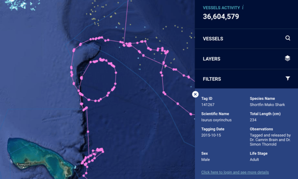
The sharks get around: One series of dots looping from the Maine coast to Bermuda and back up the coast, showing the path of a shortfin mako shark that researchers call “Oscar,” covers 22,000 miles in less than two years.

Unsurprisingly, the paths of the ships and sharks intersect, and the more mobile the shark, the more likely it risks being caught by a fishing vessel, especially in international waters in the high seas where there aren’t catch limits for many species. Sharks are both hunted directly–often for their fins–and caught as accidental “bycatch” in nets. An estimated 100 million sharks, and perhaps as many as 273 million, are killed each year from fishing activities. (Conversely, sharks kill only about six humans a year on average.)

“We thought this would be a great opportunity to overlay shark tracks to show where sharks are located in proximity to commercial fishing vessels, because sharks are extremely vulnerable to overexploitation,” says Lacey Malarky, an analyst with the illegal fishing and seafood fraud campaign at Oceana, a nonprofit that helped originally launch Global Fishing Watch along with the nonprofit SkyTruth and Google. In honor of Shark Week, Oceana worked with two shark experts to add their shark-tracking data to the map, including species like blue sharks, tiger sharks, and great hammerheads.
Though the map shows historical data now, the team hopes to soon have shark data that it can track in near-real time. It also wants to begin tracking other wildlife. “We’re hoping to expand and collaborate with more researchers to not only get more shark data but then other marine wildlife data as well, so that we can really create this interactive map platform that shows all types of marine wildlife and how they’re interacting with fishing vessels,” Malarky says.
(30)


