Who will be impacted by Hurricane Dorian? This map will tell you
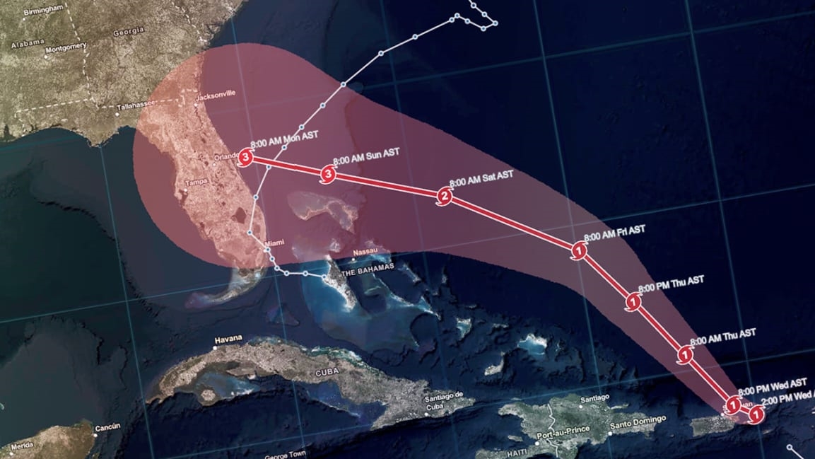
Dorian has been upgraded to a Category 1 hurricane and could strengthen to a Category 3 by the time it reaches Florida, the National Hurricane Center said today. Puerto Rico will be spared the worst of the storm, although the island was still under a state of emergency on Wednesday afternoon, and is expected to see heavy rain, winds, and flooding. Tropical storm-force winds could begin in Florida as early as Saturday. Dorian will likely hit the state’s coast sometime on Labor Day, per the Orlando Sentinel.
To help people track the storm and assess potential damage, spatial analytics company Esri updated its Hurricane Aware platform, which now includes Dorian’s real-time location and estimated path. The interactive map is also buttressed with a wealth of demographic data, including age breakdowns of the U.S. regions that will be impacted, along with information on internet connectivity, nondriving populations, and the percentage of disabled people who live in the affected areas. (Unfortunately, the demographic data is only available for the 50 U.S. states, not for Puerto Rico or other Caribbean islands in the storm’s path.)
You can check out the Hurricane Aware tool here or via the embedded map below.
(19)


